Rodrigues, Afonso 1 – Introduction and Location, Historical Review, Description e Topography
- Grupo de Espeleologia e Montanhismo, Rua General Pereira de Eça, nº30, 2380-075 Alcanena
- Núcleo dos Amigos das Lapas Grutas e Algares
- Comissão Científica da Federação Portuguesa de Espeleologia,Estrada Calhariz de Benfica, 187, 1500-124 Lisboa
Introduction and Location
The Algar da Cancela II cave is situated in the Maciço Calcário Estremenho (MCE) (Estremenho Limestone Massif), central Portugal. It lies on the Cancela slope, a hillside of an elevation located near the southern limit of the MCE, between the Serra dos Candeeiros and the Polge da Mendiga, not far from the town of Xartinho. The geographical coordinates (WGS84) of the cave entrance are: Latitude: 39.44497º, Longitude: −8.87281º, and approximate Z (elevation) of 297 metres.
Historical Review
It was possible to ascertain the existence of 2 historical work campaigns in this cave, although it seems highly likely that the cave had a lot of undocumented visitation and work.
- Ferreira (1962) presented a note about the cave in SPE (Portuguese Speleological Society) bulletin. This included the geographical location, local geology, speleogenesis, speleomorphology, and a profile of the initial part of the cave, including the entrance shaft. Access to the rest of the cavity is marked with a question mark. It is assumed that an unblocking/clearing operation was carried out in this area after the topography was made, granting access to the rest of the cavity. The quality of the article should be highlighted. Noteworthy is the fact that the best description of the cave entrance, "algar-rampa" (shaft-ramp), is found in this article..
- The cave was visited by speleologists from GEM and AESDA (Association for Subterranean Studies and Environmental Defence) in 2017. Following this visit, a group of speleologists from various associations carried out laborious unblocking works and the topography of the cave (which can be seen in Figures 3 and 4). We thank Bruno Pais (AESDA) for providing the topography and helping with the historical review. This is the first known integral topography of the cave. The names of the field team and the topography authors can be consulted in Figures 3 and 4.
Description
Starting from the vertical and rounded entrance, which opens in a cornice (Ferreira, 1962), one descends a series of drops that lead to a chamber. This chamber has a block floor and a ceiling/walls deeply marked by spongy dissolution (spongiform dissolution), with some associated speleothem deposits (concretion). The series of shafts and drops has a vertical extent of approximately 20m. At the south end of the chamber, there is a small shaft filled with stones, corresponding to the deepest point of the cavity. The cave continues north, ascending a stalagmitic flow in a heavily concrecionated area. The route continues through a low and relatively inconspicuous passage, with the subsequent section being narrower and muddier. Several small chambers are passed, featuring ceiling pockets (ceiling cavities/cupolas) that reveal old circulation under pressure. One also sees suspended calcite shelves formed when the conduits would have been silted up.
There is a gallery that branches off again to the south, terminating very close to the end of another small meander, and the hypothesis is raised that there might have been a past connection. Decimetre-sized erosion scallops are visible in several of the passages. Eventually, a near-vertical drop is reached, leading to a larger chamber where prominent ceiling channels can be seen.
In this area, the configuration of the cavity changes. The pressure tubes give way to two or three large, widened vertical discontinuities covered in coralloids. This final section has the appearance of vadose genesis. The ceiling of the passages is likely very close to the surface, and there is an impressive root crossing the main joint (or fault). Furthermore, a small draught (air current) is felt at the bottom, possibly from an inaccessible second entrance.
Speleometry
A new survey (topography) of the cave was carried out, yielding the following speleometric data:
- total development (length): 152m;
- horizontal projection (plan length): 133m;
- denivelation (Depth): -25m.
The speleometric data is compatible with the topography provided by Bruno Pais.
Rigging guide
The rigging guide/log for the cavity is shown in the profile (see Figure 9).
Geological Setting
According to sheet 27-C of the Geological Map of Portugal at a 1:50,000 scale (Manupella et al), the cave develops in the Camadas de Cabaços and Montejunto formation, dated from the Middle to Upper Oxfordian stage (Upper Jurassic Epoch). The layers are locally quite folded, albeit irregularly, indicating a zone of greater deformation. This is not surprising given the proximity to the Arrife thrust fault (cavalgamento do Arrife), located about 650m south of the cave (see Figure 10). The area also shows several faults sub-parallel to the Arrife (NNW-SSE to NW-SE), although some later turn north or west.
As a point of interest, the Arrife thrust fault, while causing a considerable controlling slope of about 300m, does not have the same verticality as other Arrife cliffs. This is because part of the slope consists of Upper Jurassic terrigenous deposits, which cannot maintain sub-vertical faces.
Structural Control
The cave's structural control is mainly determined by the attitude of the layers, except for the terminal zone. The layers have an approximate attitude of N40E/30∘E, with the gallery following either the strike or the dip in approximately perpendicular sections. The main direction of the gallery's development is close to the strike of the layers. However, the terminal section of the gallery is controlled by a discontinuity with an approximate attitude of N70W/Subvertical. As this coincides with a mapped fault (see Figure 11), we consider it to be a fault..
Genesis and Evolution
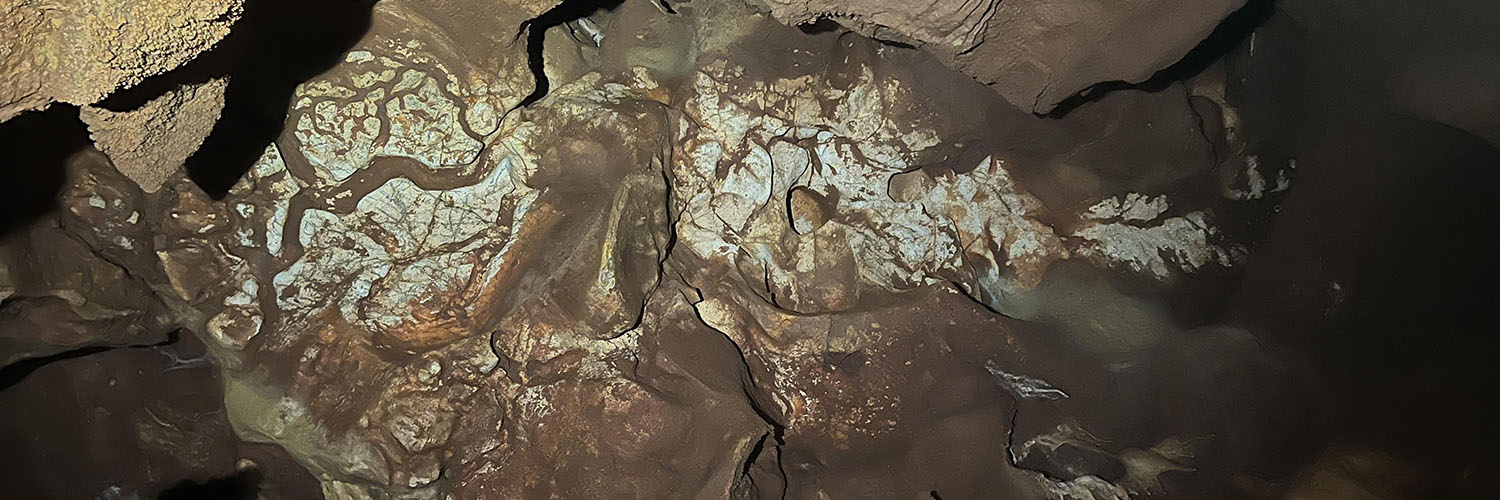
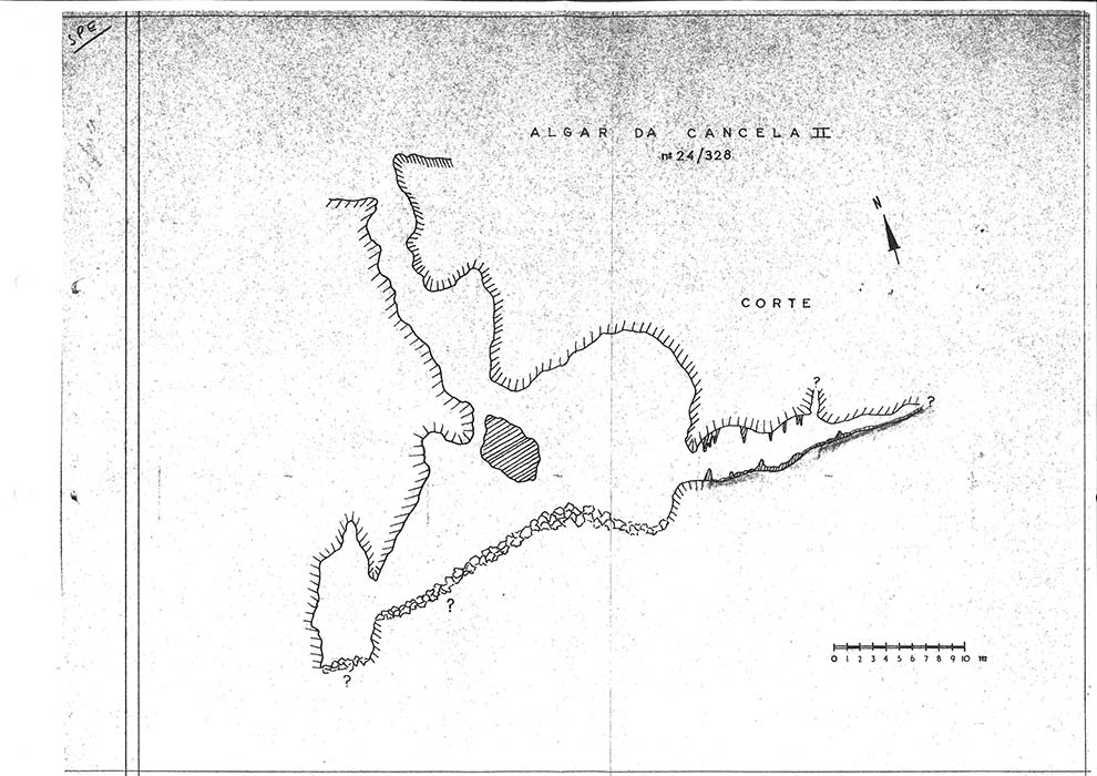
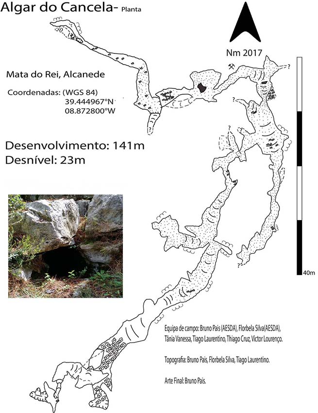
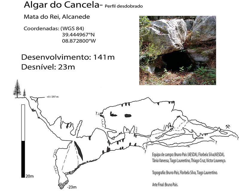
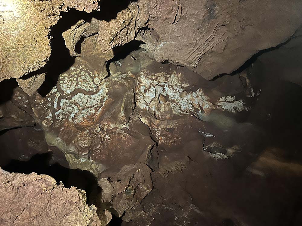
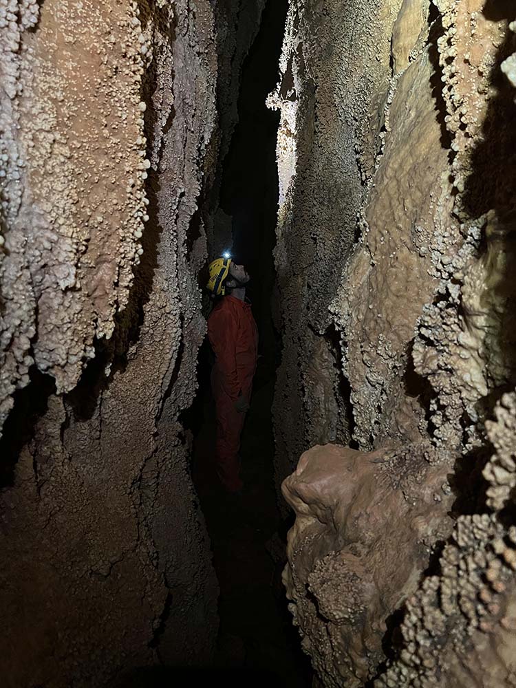
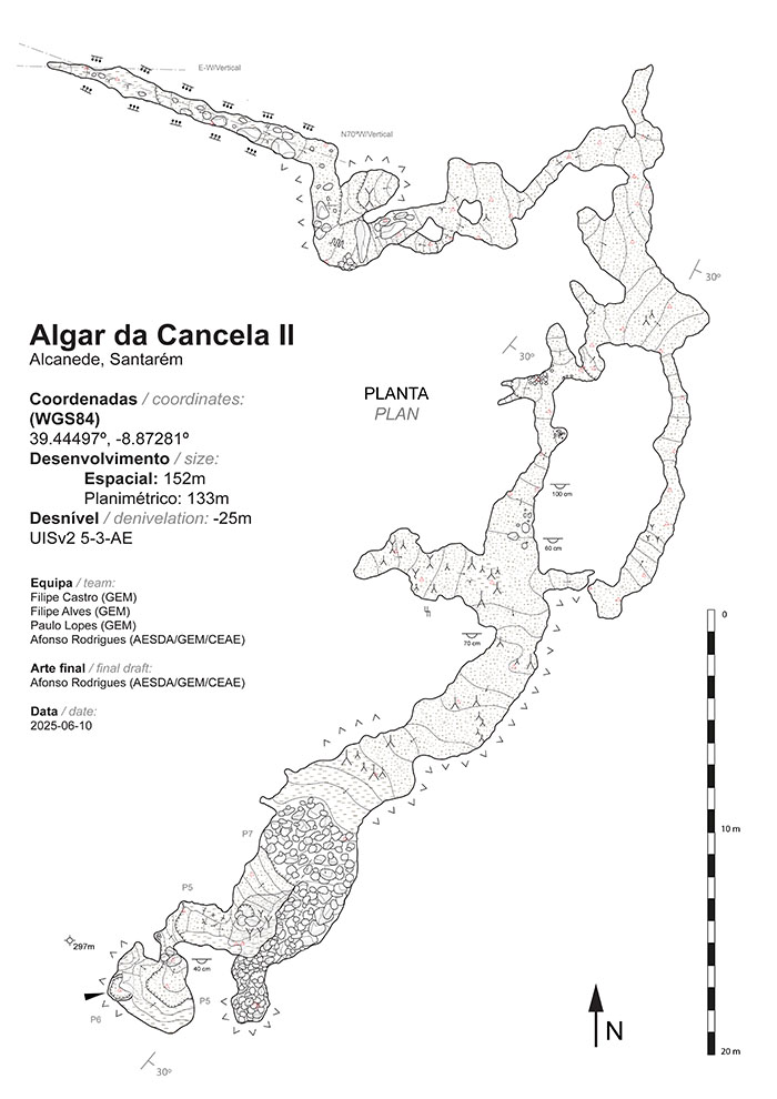
The cave was formed in the phreatic zone according to Bögli's definition (1980). This is evidenced by the rounded section of the galleries, erosion scallops, ceiling cupolas, and ceiling channels. The erosion scallops generally have an approximate length between 0.4 and 1.0m, with the most common length being between 0.6 and 0.7m.Most scallops are symmetrical, but some point towards the cave mouth, indicating an ancient direction of water circulation of NE-SW.
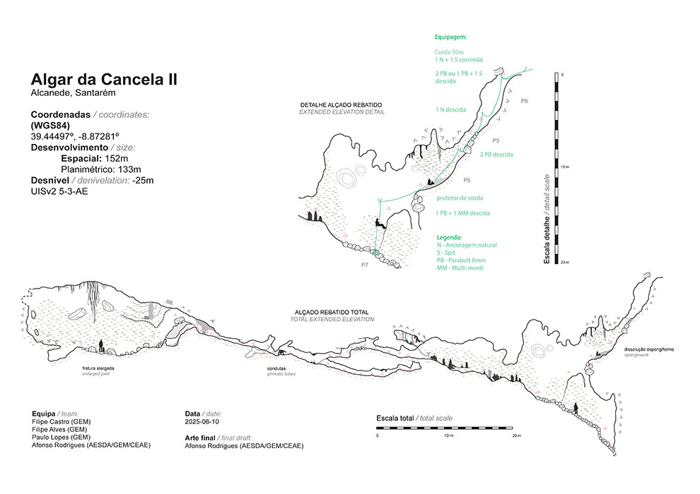
The cave subsequently silted up, resulting in the abundant clay deposits that fill most of the gallery space. Then, due to a relative lowering of the base level, the cavity moved from the phreatic zone to the inactive vadose zone.
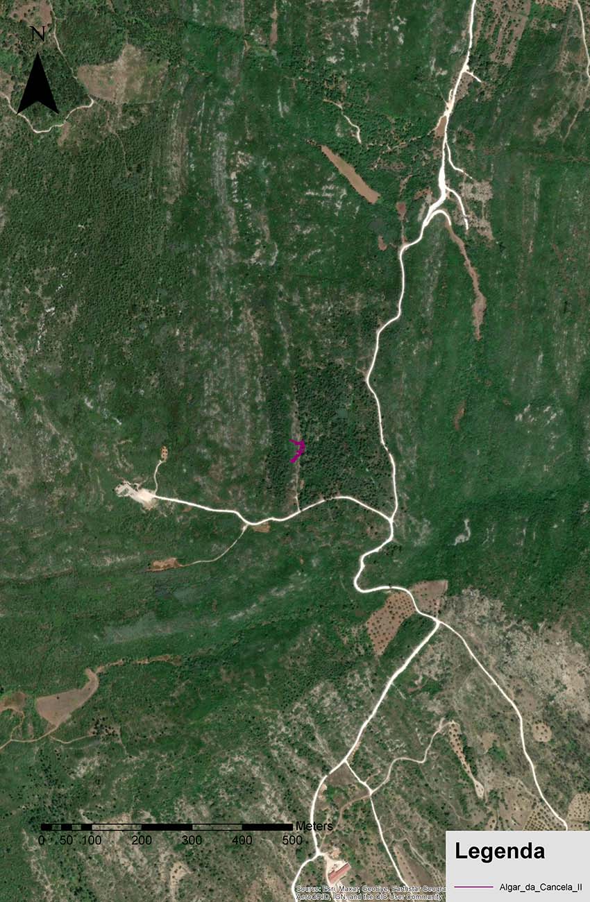
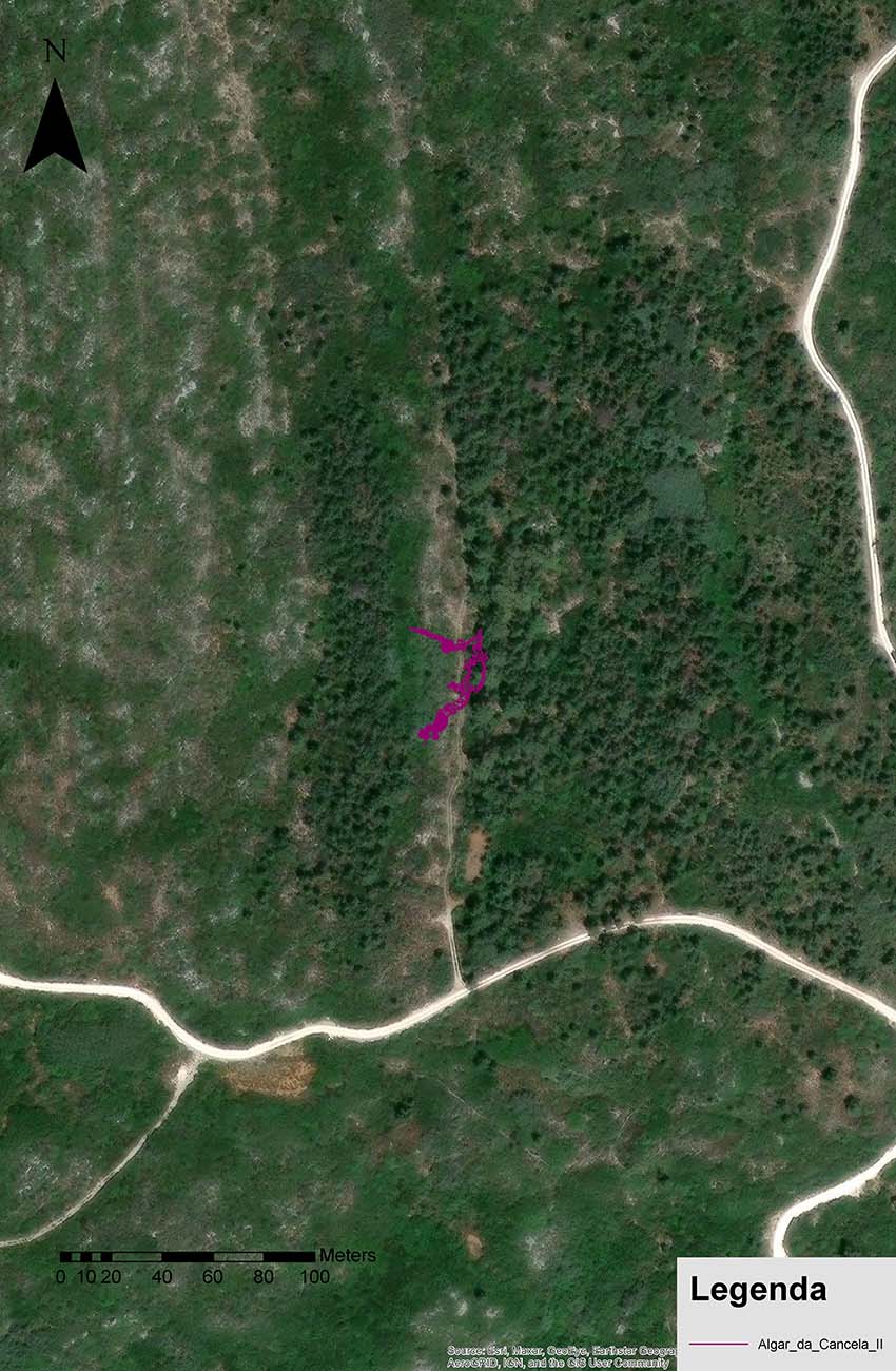
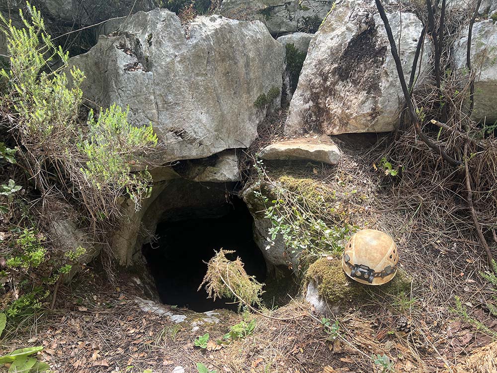
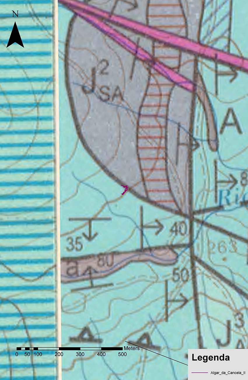
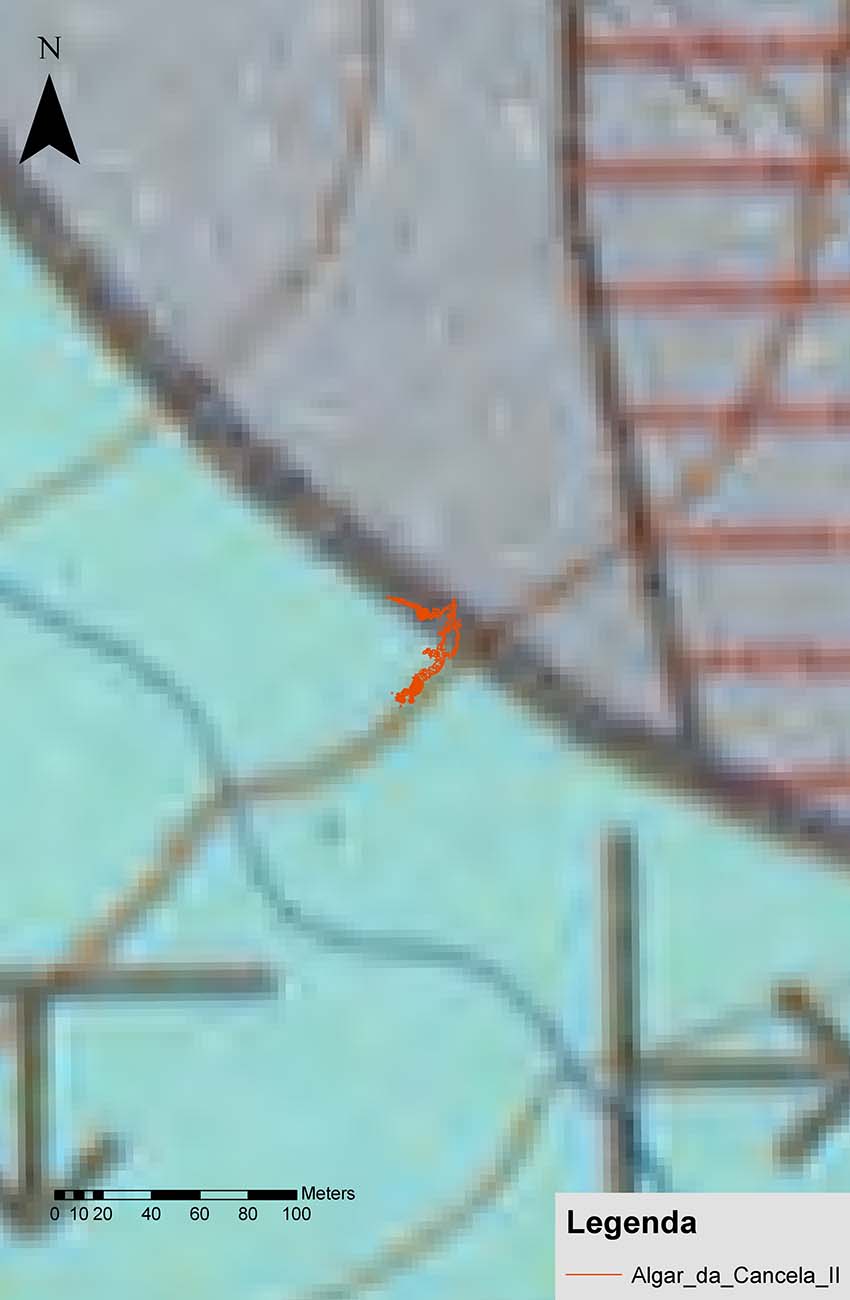
Algar da Cancela II marks an ancient level of water circulation that is currently at an approximate elevation of 280-285m. The cave entrance may have been an ancient spring, as suggested by its phreatic appearance, proximity to the Arrife thrust fault, and the contact of the MCE with non-karstic terrain. We recall the Alcobertas spring, located just over 3 km SW of Algar da Cancela II, which is a current permanent spring situated in a similar geological context (formed in Upper Jurassic terrain and near the contact of the MCE with non-karstic terrain).
Conclusions
Algar da Cancela II is a cave of phreatic origin, which marks an ancient circulation level, currently at an approximate elevation of 280-285m, and which developed in Upper Jurassic Limestones. The cavity has a total development of 152m, a horizontal projection of 133m, and a depth of -25m.The cave is primarily controlled by the strike of the layers and, in its terminal zone, by a fault. The cave entrance may have been an ancient spring.
Fieldwork Team
The fieldwork team consisted, in alphabetical order, of: Afonso Rodrigues (AESDA/GEM/CEAE), Catarina Teixeira (GEM), Filipe Alves (GEM), Filipe Castro (GEM), Paulo Lopes (GEM), and Pedro Cardoso (GEM/NECA).
Bibliography
- Bögli, A. (1980), Karst Hydrology and Physical Speleology, Springer-Verlag, Berlin Heildelberg New York.
- Crispim, J.A (1995). Dinâmica Cársica e Implicações Ambientais nas Depressões de Alvados e Minde (Karstic Dynamics and Environmental Implications in the Alvados and Minde Depressions). PhD Thesis in Geology, specialty in Environmental Geology. Geology Department. Faculty of Sciences, University of Lisbon.
- Ferreira, Jaime Martins, (1962), Nota sobre o Algar da Cancela II (Note on Algar da Cancela II), Bulletin of the Portuguese Speleological Society, Vol. II, No. 1.
- Manupella, G., Barbosa, B, C.A., Azerêdo, Carvalho J,; Crispim, J., Machado S.; Sampaio J.; (2006). Carta Geológica de Portugal –Torres Novas, Folha 27-C, á escala 1:50000, e Nota Explicativa (Geological Map of Portugal – Torres Novas, Sheet 27-C, at 1:50,000 scale, and Explanatory Note), Instituto Nacional de Engenharia, Tecnologia e Inovação, Lisboa.
